

HomeFeatures
Keep your investigation moving from fieldwork to reporting
From recording soil investigation data to assessing laboratory results and preparing reports, TerraBase keeps your project information connected.
Field observations sit alongside locations, photographs, documents and laboratory information, giving your team the context they need at each stage. With browser access to centralised project records, colleagues across offices can work from the same information.
Choose the modules that fit your workflow and explore the features below.
Request a demonstration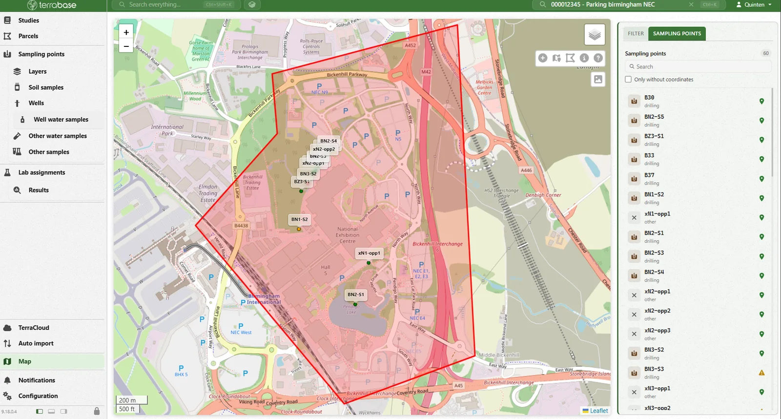
01Fieldwork and data capture
Record the detail while you’re on site
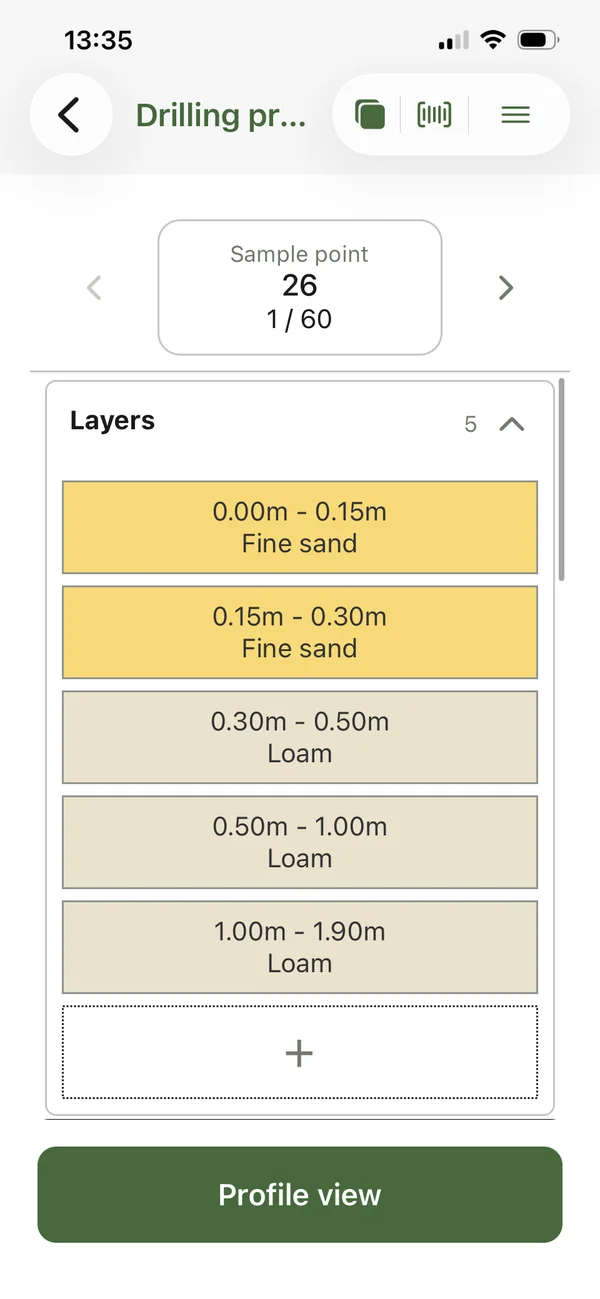
The renewed TerraBase Fieldwork Module makes it easier to find the information you need and enter observations with fewer steps. Spend less time working through data entry and give the office a more complete record of the investigation.

Keep photographs and documents with the observation
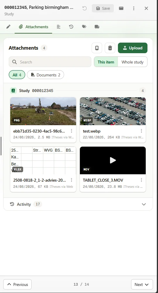
Add site photographs and supporting documents through the Fieldwork App and link them to the relevant investigation information. A photograph of ground conditions or an accompanying sketch stays with the record it helps explain, ready for colleagues to review within TerraBase.
That saves time looking through separate folders and gives the person assessing the data more context about what was recorded on site.

Reduce additional handling of field data
Record information in a structured form so it is ready for the next stage of work. Existing barcode scanning and support for compatible multiparameter field meters help reduce manual entry when recording sample references and measurements.
The Fieldwork App also supports offline working, allowing observations to be recorded where a connection is unavailable and shared with the office once connected.
- Barcode scanning
- Multiparameter field meters
- Works offline
02Mapping and visualisation
See your findings in the context of the site
The Maps Module displays boreholes and other investigation points on an interactive map, helping you understand where work has taken place and how locations relate to the project area.
Use the geographical overview to explore the investigation and find the project information you need. It provides a useful starting point when reviewing a site with multiple investigation locations.

Mark the areas that matter
Draw figures and areas directly on the map to define investigation zones or highlight a location that needs attention. Keep those areas visible alongside the investigation points to make the scope of the work easier to understand.

Review the spatial picture
TerraBase’s existing mapping tools also support the display of soil layers and selected analysis results, contamination contours and automatically generated cross-sections. These views help you examine how findings relate across the investigated area.
03Laboratory workflows
Move samples and results through the project with less administration
Create digital laboratory assignments from recorded field data, including sample references and barcodes. Using information already held in TerraBase reduces the need to enter the same details again when preparing work for the laboratory.
 Field recordsSample references and barcodes
 Laboratory assignmentSent directly to the laboratory
 Returned resultsKept with the investigation
Send assignments directly to the laboratory and receive analysis results through supported laboratory connections. Keep those results with the investigation information so they are available for assessment and reporting.
For the office team, this makes the connection between field records, laboratory work and returned results easier to follow.
04Testing and assessment
Review results with the information you need alongside them
The redesigned Testing & Assessment Module provides a clearer way to navigate investigation and laboratory data. Find the relevant results and work with assessment criteria in the same environment, reducing the amount of information you need to gather from separate sources.

Apply the criteria relevant to your work
Assess results against supported national or local standards and work with your own assessment tables and remediation values where required. Keeping criteria alongside the results supports a consistent approach to reviewing project information.

Keep interpretation connected to the investigation
Review the results in the context of the wider project record, with supporting investigation information available within TerraBase. This helps you follow the assessment process and prepare the information needed for reporting.
05Reporting and data exchange
Get project information ready for the people who need it
Prepare reports and share investigation data in formats that suit the next stage of work. TerraBase supports outputs including PDF and Word reports, Excel assessment results and summary lists, alongside supported data formats and web services.
Use the information already held in the project to reduce repeated entry when preparing material for clients, authorities and other project partners.
- PDFPDF reportsReady to share
- DOCWord reportsEditable documents
- XLSExcelAssessment results and summary lists
- Data formatsAnd web services, including AGS
New for UK projects
AGS export for UK projects
TerraBase now supports export to the AGS data exchange format, giving UK teams a structured way to transfer geotechnical and geoenvironmental investigation data between organisations and software.
Prepare an AGS export from the project data and use it as part of the information you deliver to clients and project partners. Contact us to discuss the AGS requirements for your workflow.
 Export to the AGS data exchange format
 Transfer data between organisations and software
 Keep a consistent data structure throughout the project
See how TerraBase fits your work
Tell us how your team manages investigations. We’ll show you the relevant features and discuss the modules that suit your projects.
Or speak to us on +32 (0)9/33 88 252
or email info@i-theses.com