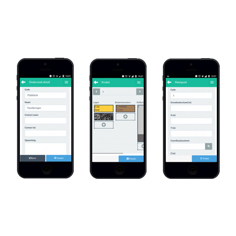
Efficiency in the Field
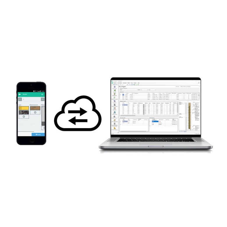
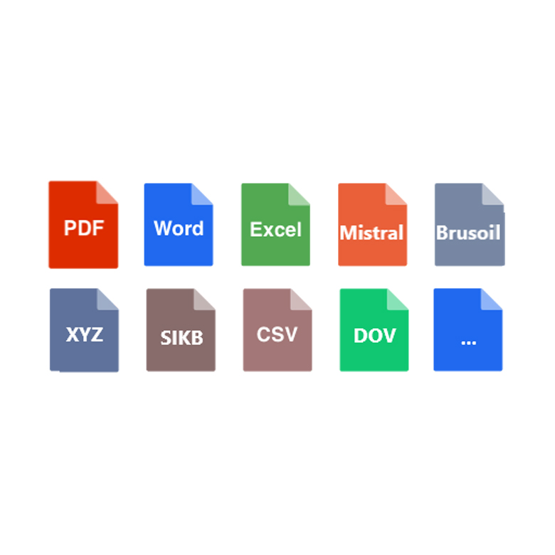
Expertise at your Fingertips
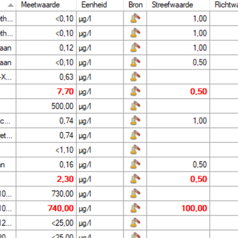
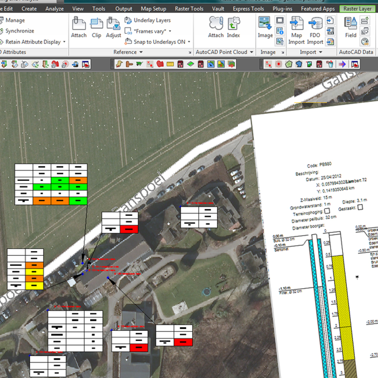
Fast & Accurate Visualisation
Terrabase
MODULAR SOFTWARE FOR SOIL SURVEY & GROUND INVESTIGATION
TerraBase is comprised of a number of software modules for carrying out fieldwork, administrative processes, map creation/contours, analyses, assessments and reports.
These modules can be used individually or as a complete package, allowing you to tailor the software to meet your specific requirements.
Terrabase
Features

01
User-friendly fieldwork applications
Record your fieldwork quickly and accurately with a user-friendly app on your smartphone or tablet. Make use of the camera to scan barcodes or connect with an external barcode scanner.

02
Communicate securely and efficiently
Make use of a secure cloud exchange to share data to and from a central database. This makes the work recorded in the field immediately available in the office for creating lab assignments. The app also works offline, so you aren’t dependent on an internet connection.

03
Measure faster with multimeters
iTs TerraBase provides support for reading data from various types of multiparameter field meters. New types can be supported via manual addition by the user.

04
Create lab assignments quickly
Create digital lab assignments based on your recorded field data (e.g. barcodes) and send them directly to the lab. The results of the lab analysis are then sent and received automatically.

05
Accurately analyse results against standards
As soon as the analysis results are automatically sent through, they can be assessed against national and/or local standards. You can create your own assessment tables based on Excel, define remediation values and make assessments against them.

06
Create accurate maps and cross-sections with ease
Once the information on soil layers, measurement locations, and lab results is available, it can be visualized on maps. Measurement points are drawn directly in the correct location based on the coordinates. You can choose which analysis results you want to display on the maps. The contours of contamination are determined automatically. This way of working allows you to quickly perform a spatial analysis. You can also automatically generate a cross-section of the investigated area.

07
Report to clients and authorities effectively
iTs TerraBase is a data exchange champion. You can import and export to dozens of formats and web services. Read coordinates, exchange data with web services from authorities or laboratories, create reports in PDF or Word. Generate Excel documents with assessment results, summary lists and so on.
Terrabase
Upcoming Events
September
Time
September 17, 2025 - September 18, 2025 (All Day)(GMT+00:00)
Location
NEC
National Exhibition Centre, Pendigo Way, Marston Green, Birmingham, B40 1NT